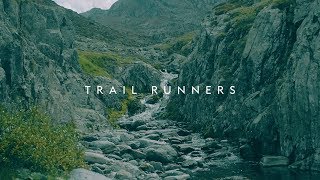
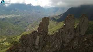
Cape Verde, the country where even grey is colorful
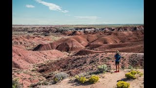
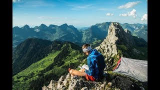
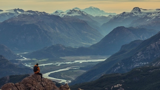
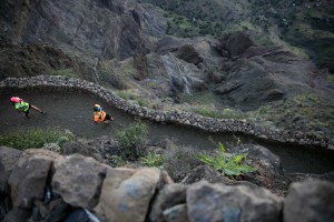
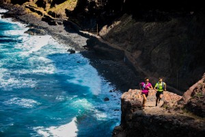
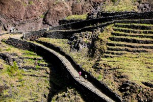
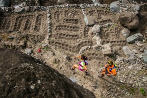
Cape Verde, a trail-running paradise. The archipelago is composed of 10 volcanic islands and is a lost paradise off the coast of Mauritania.For runners it is quite simply utopia. Extraordinary trails wind up and down in the most improbable places: for the locals to move around and to access the agriculture.Madeiran workers came and paved these paths, a Herculean task that is simply sublime to behold. Here the islanders have sadness and joy mixed with an attraction that draws them out to sea.
Pictures Franck Oddoux
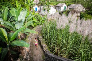
Trail runners suffer from ‘homesickness’ when they must climb back into the plane for that violent return towards their turbulent continent.Our heart swings for San Antao, the magical volcano. The upwind side is green, almost tropical, and the downwind side is desert-like dried by the enduring heat of the sun. And everywhere there is this tumultuous geological presence: volcanic cones, jet-black rocks, and calderas…


Caroline Benoist and Anthony Gay explored the tracked itineraries, but sometimes had to invent them, unleashing their imagination. From the depths of the mineral furnaces to the luxurious valleys, Cape Verde offers a palette of pure exoticism.


Caroline Benoist et Anthony Gay’s road map :
Etape 1
Start : Maderal.
Arrival : Calhau.
Distance : 17.7 km
Elevation : 460 m
Downhill : 480 m
Etape 2
Start : Campo Redondo.
Arrival : Chã de Morte.
Distance : 20 km
Elevation : 450 m
Donwhill : 1350 m
Different way :
Summit TOPE DE COROA
Distance : 4.4 km
Elevation : 320 m
Donwhill : 320 m
Etape 3
Start : Maison forestière d’Agua das Caldeiras.
Arrival : Chã de Pedras.
Distance : 26 km
Elevation : 800 m
Downhill : 1800 m
Etape 4
Start : Boca de Ribeira.
Arrival : Ponta do Sol.
Distance : 23.5 km
Elevation : 1050 m
Dowhill : 1300 m
Etape 5
Start : Boca de Figueiral.
Arrival : Janela.
Distance : 19 km
Elevation : 1600 m
Downhill : 1650 m
To go…
Chamina Voyages Agency knows by heart Cabo Verde trails. Contact : www.chamina-voyages.com. Théo Lautrey, lives at Cabo Verde, he is in charge of all the itineraries.
Transamericana avec Rickey Gates