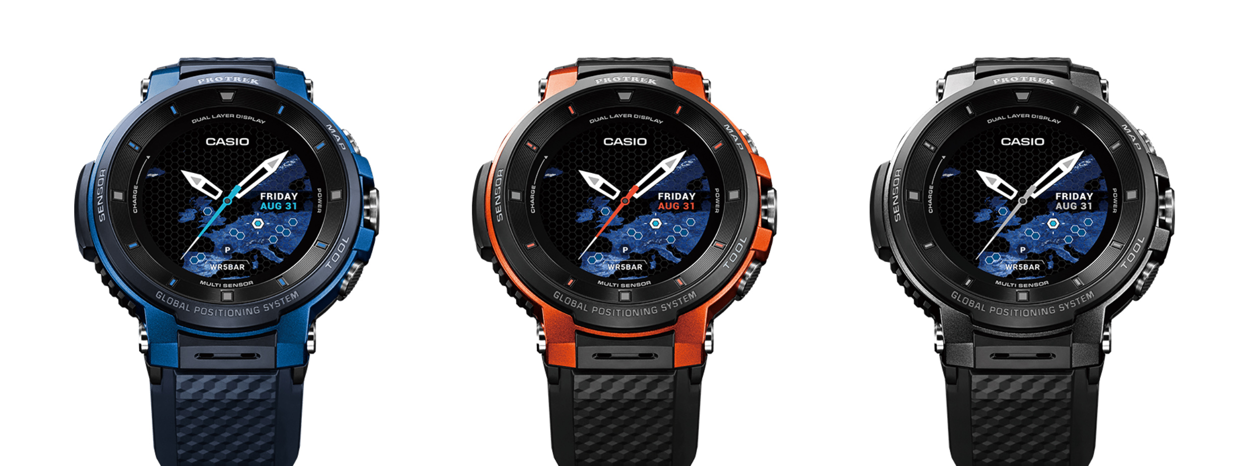
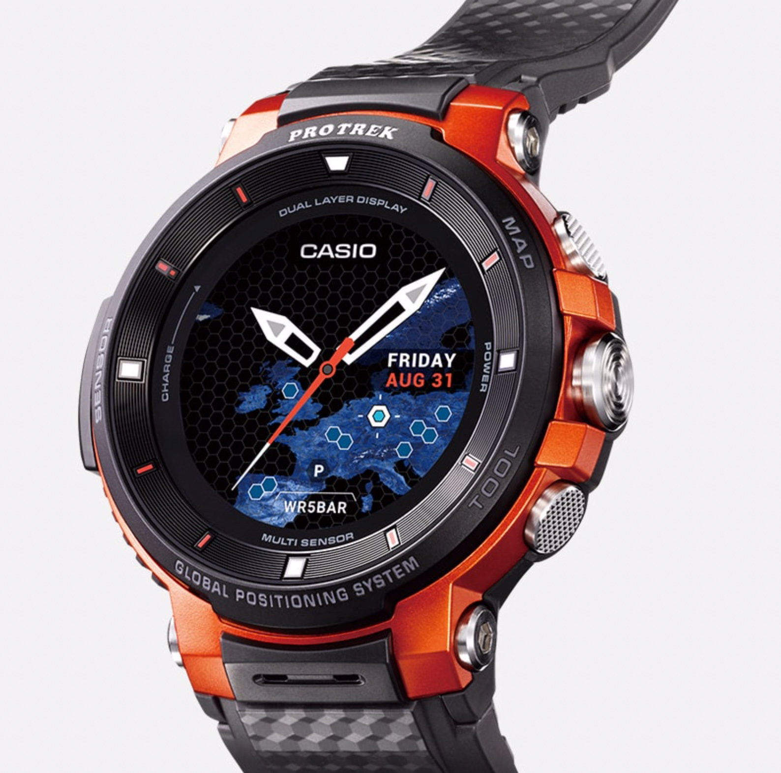
Casio, the historic leader in adventure watches has moved over to leave Garmin, Suunto and Polar the outdoor sector. However, the Pro-Trek series, that was made famous by the Raid Gauloises (the brand was a partner of this legendary event), have not said their final word. This Japanese brand’s products focus on orientation / mapping rather than training. The Test4outside.com team had the opportunity to test the new Casio WSD 30 over a period of several months.
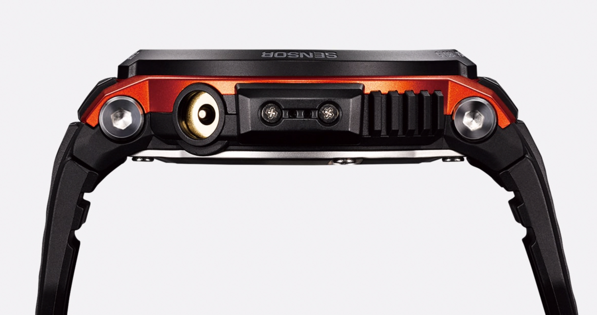
Before using, charge the watch. Three good hours are needed for a full charge. CASIO has unfortunately not changed its magnetic connectors, and if you are not careful the cable comes off very easily and therefore preventing charging. So you must keep the watch stable during charging. CASIO should provide a system that keeps the cable in place.
Like its predecessors (the F10 and F20), getting started, setting it up and connecting it to Wear OS (the software that synchronizes the watch to your smartphone) are very straight forward, guided and intuitive.
The smartphone must of course be at hand for this installation (synchronization of e-mail accounts, contacts, etc.)
Once this first set-up is done, all menus and different watch screens are then accessible.
CASIO has kept the previous models’ logic: a touch screen where you click to select, you scan from right to left or from top to bottom to change the menus or a long press on the screen to change the watch dial.
Three buttons (two configurable) allow access by default:
– basic mapping (location memory)
– tools (compass, altimeter…)
– apps and parameters.

Since we tested the CASIO F20 in 2017, it took a few hours to fully understand again how to use the watch.
That said, the quick-guide for downloading from the CASIO website is well done and shows you how to navigate around all the watch’s basic features.
The user manual (to download too) describes the functions more precisely (GPS navigation, app activity, etc.).
The watch’s logic is very different from other models on the market (Garmin, Suunto, Polar …).
Therefore, it is recommended that you follow the instructions on the first pages.
Here are the latest differences to the first versions (2017) of the previous F20 models:
– improved screen definition. The watch is equipped with an OLED color display (LCD on the F20) with a resolution of 390 x 390 pixels (instead of 320 x 300 pixels).
The touch functions have significantly improved but, most are not accessible using the buttons, the touch screen remains a problem for an outdoor watch, especially in winter, and with gloves it’s complicated.
– Some new watch dials including one, “2LAYERS”, which provides additional info like an altimeter and compass.
– the function “ok Google” (Google assistant) has been integrated with WearOS (accessible by right sweep of the touch screen)
The speech synthesis is excellent, whether for the Google assistant or the text message dictation.
– Three different energy saving modes:
1stmode: normal mode (connected watch, 1.5 days of battery life, slightly improved compared to CASIO F20)
2ndmode: “Extend mode” (3 days including 8 hours of GPS use, but with only three GPS measurement intervals 1min, 6mins, 10mins)
Admittedly, in this mode we double the autonomy but programming the ranges of use and pause is restrictive compared to real activity during a trek or a mountain trip.
You must define a project:
– an activity period
– a break period
– another activity period.
Very restrictive mode that leaves no room for error, delay, or simply improvisation when you’re out.
In addition, when the Extend mode is switched on, the watch automatically switches to “watch only” mode until the first activity period.
If you want to redo a position, then you have to restart the watch …
3rdmode: “multi-function time machine”, basically a simple disconnected watch (two options: outdoor with altimeter and compass, or daily: just the watch)
To manage the autonomy, we would have preferred that Casio create a single mode that presents all the energy consuming functions (GPS, Google assistant, notifications, Bluetooth, Wi-Fi) and offers to activate / deactivate according to the desired use, indicating a gain in autonomy, like smartphones.
(See the autonomy test in the next chapter).
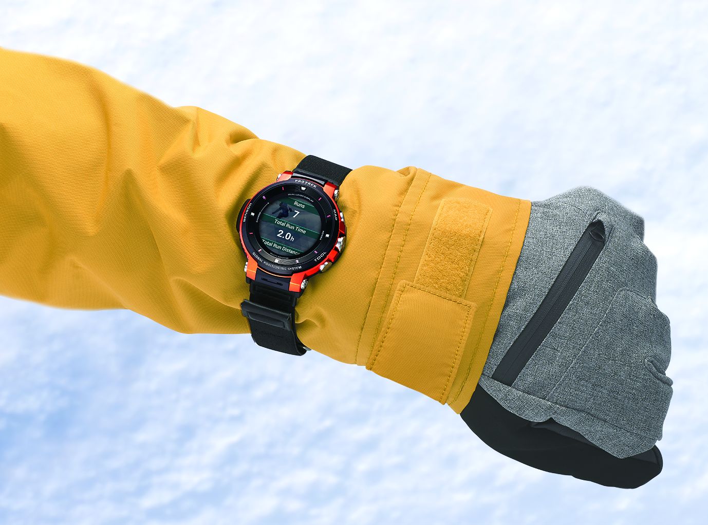
– a “Snow” mode in addition to the “Hiking”, “Fishing” and “Cycling” modes
in the “activities” app, you can do the parameters in the CASIO MOMENT SETTER app.
– Navigation
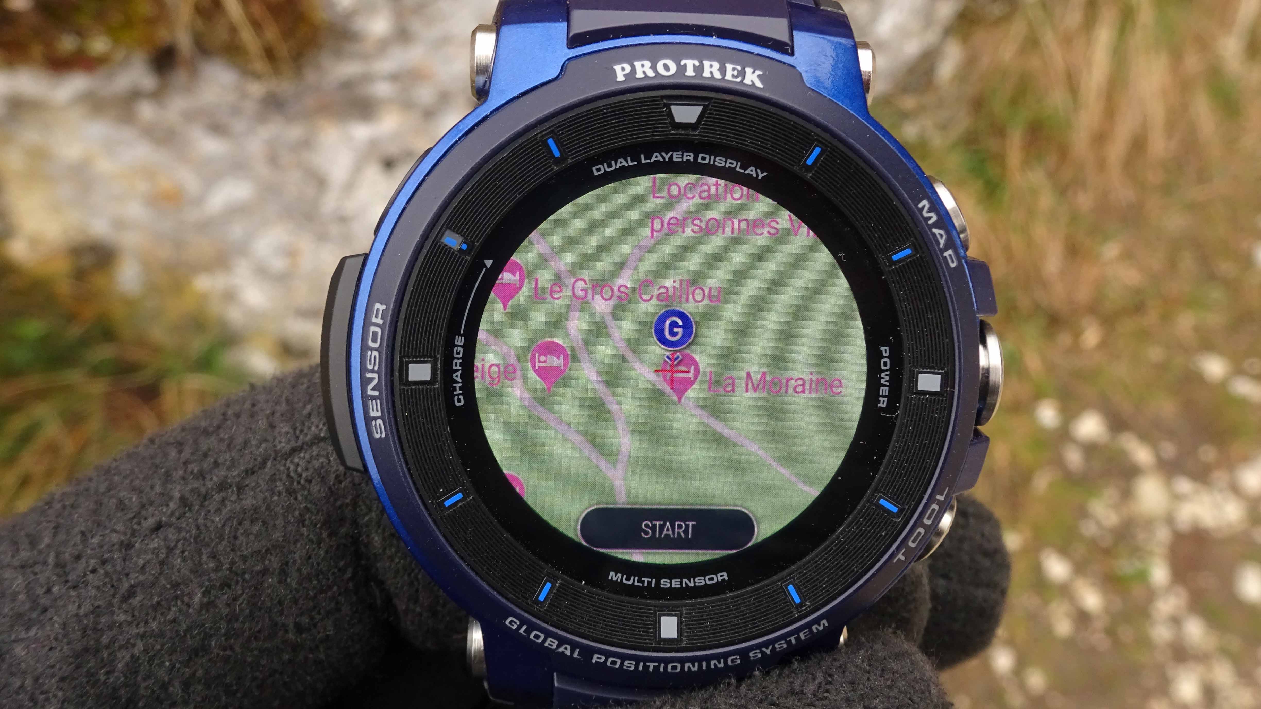
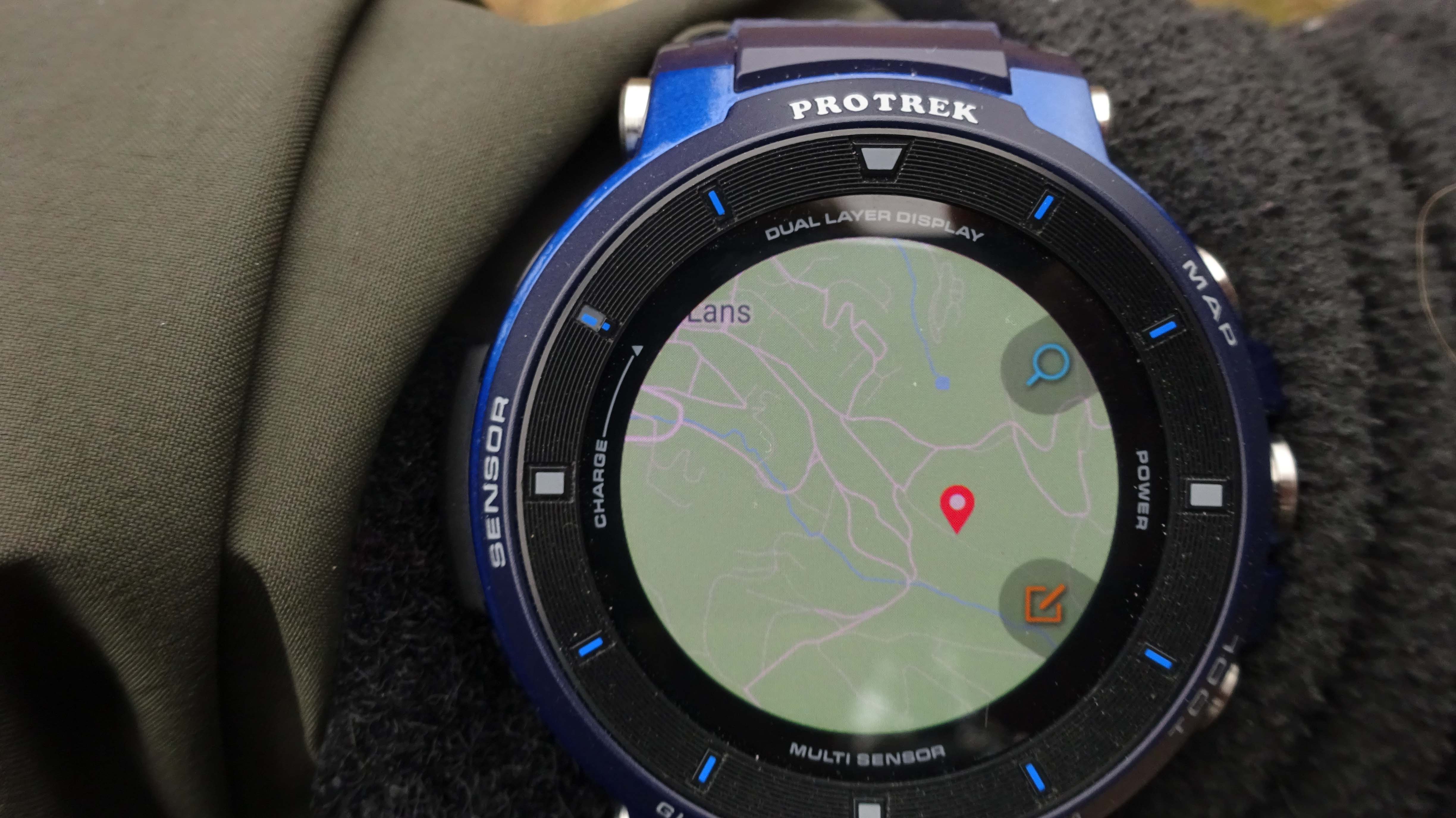
On a hike you can specify a point on the map on the “memory location” app and navigate to it.
(See the navigation test in the next chapter).
Outside test.
At first, we tested the different functions and the watch’s practical side on short outings. We also focused on navigation, the other functions have changed very little.
The watch is quite bulky (not easy to slip under a long-sleeved shirt) but not too heavy.
The watch strap is not very comfortable after a few hours wearing it, there’s some irritation probably due to the bracelet’s hard plastic.
But the bracelet is easily replaceable, CASIO should offer braided bracelet models, more comfortable and so you could put the watch on the outside of the sleeve of a jacket for example.
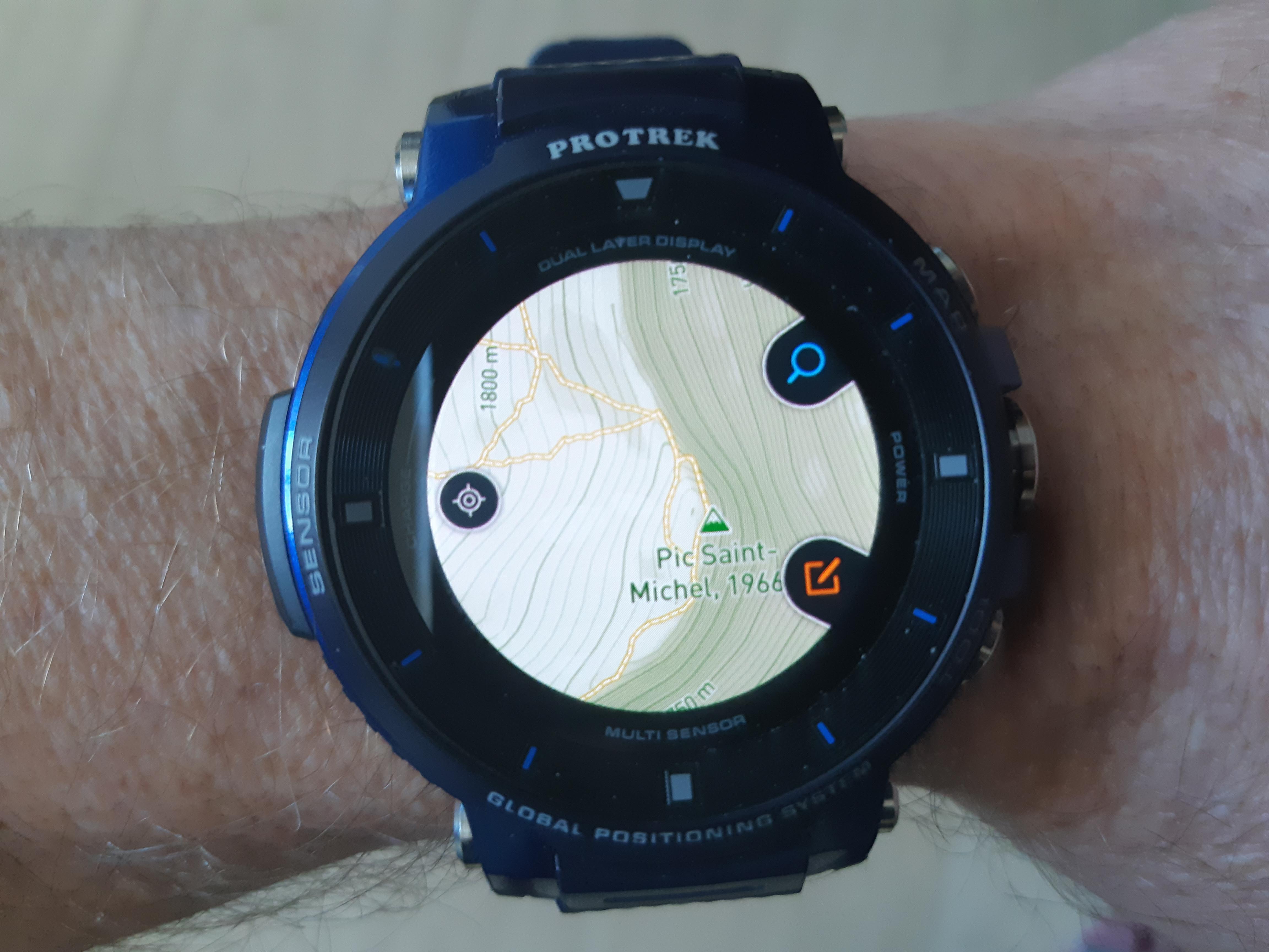
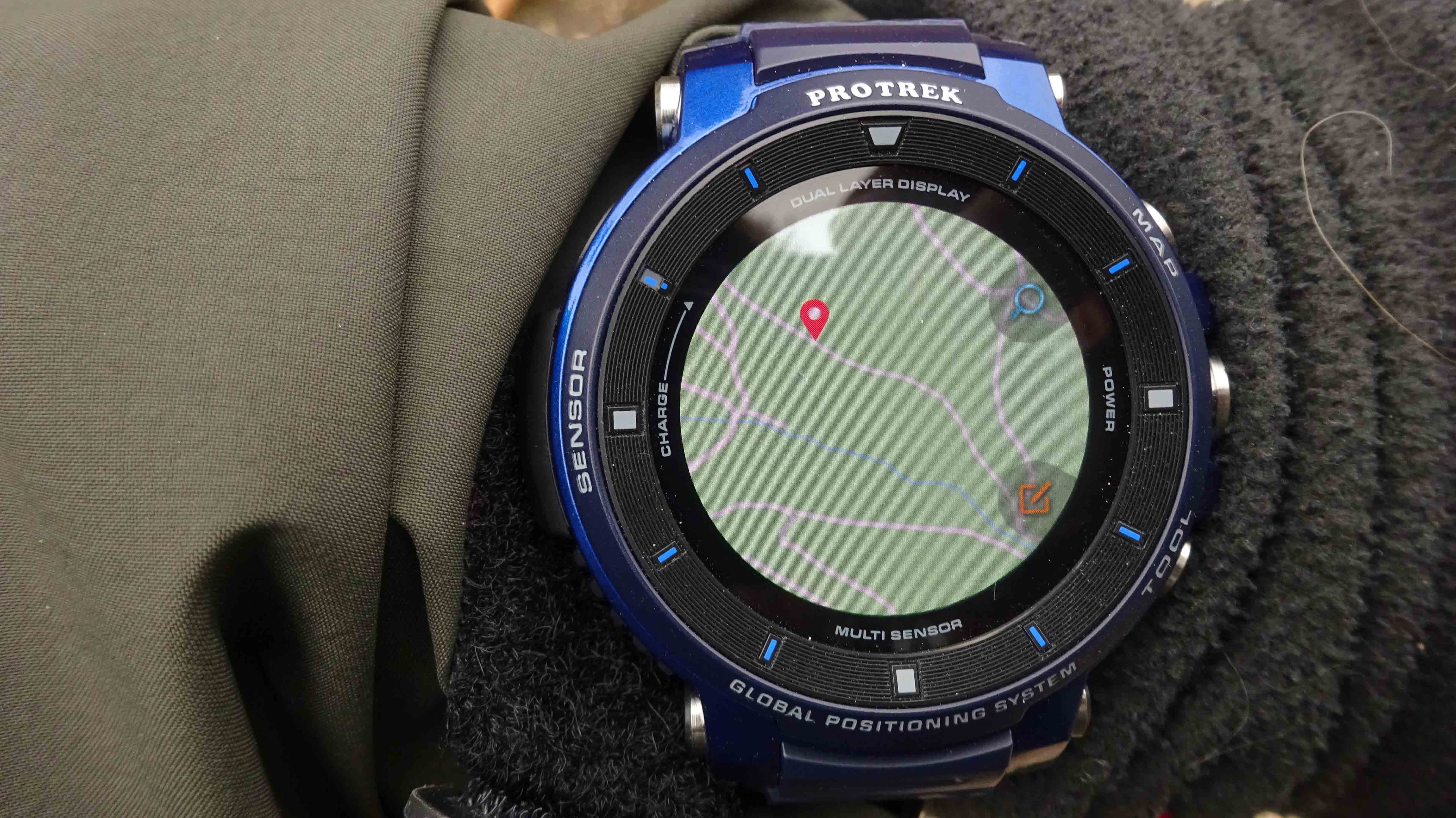
The default map (location memory), despite an increased screen definition compared to previous models, given its small size, remains quite exploitable. Just useful to know your position and possibly download it onto a more legible system.
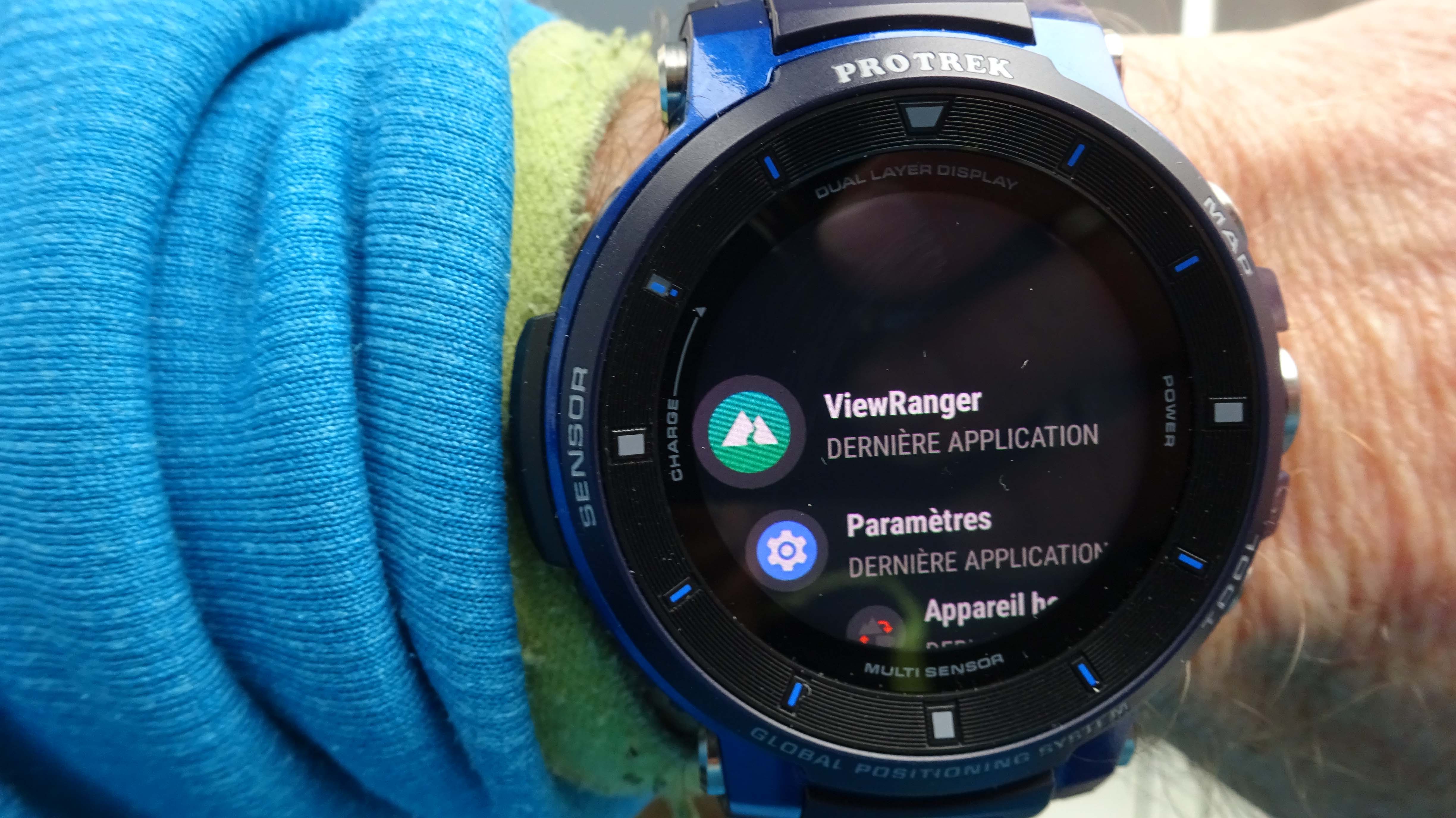
We downloaded the android Viewranger app to increase the scope of the mapping functions.
The zoom functions are the same as the default app rental memory (pictograms magnifying glass, + and -).
And to move the map, press once on the screen and then scan the screen in the desired direction.
Download maps:
Once Viewranger is installed, you must choose the area to download (smartphone, Wifi and Bluetooth are necessary, so an operation to do at home).
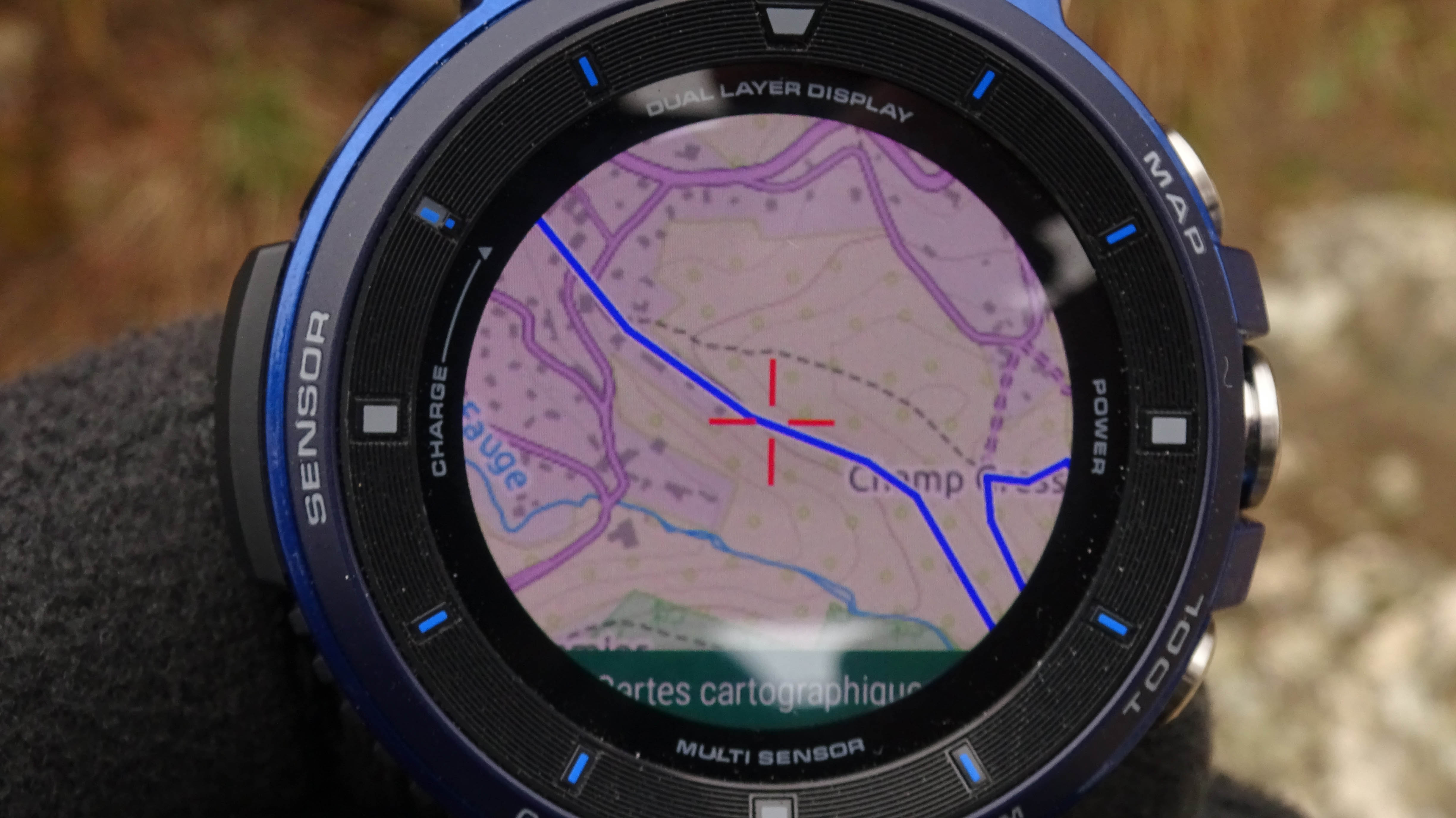
On the watch, we chose the “landscape Viewranger ” maps whose definition is close to an IGN map (contour lines every 10m) without equaling it in terms of accuracy.
The zone has a limit indicated by a red rectangle on the map.
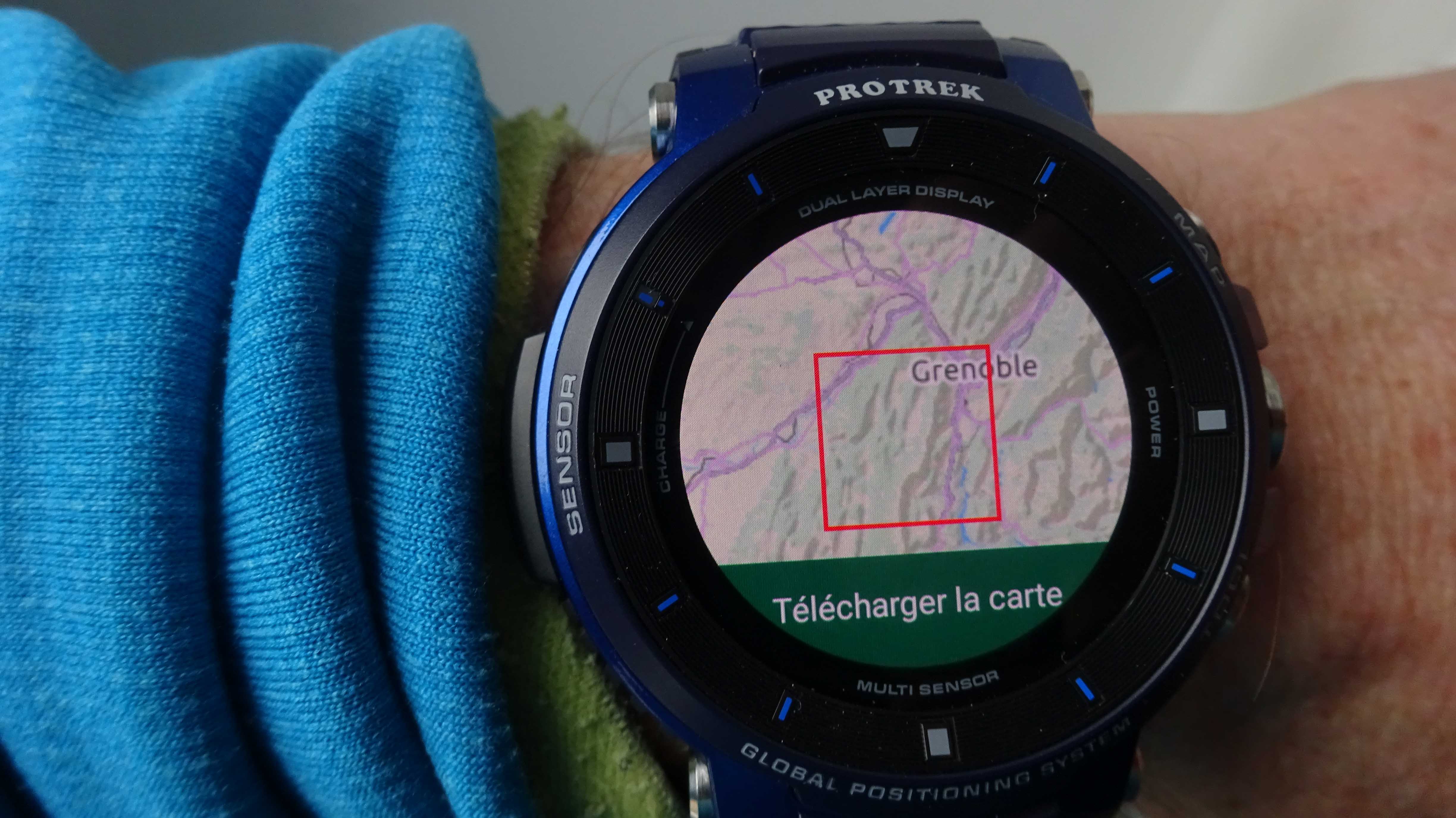
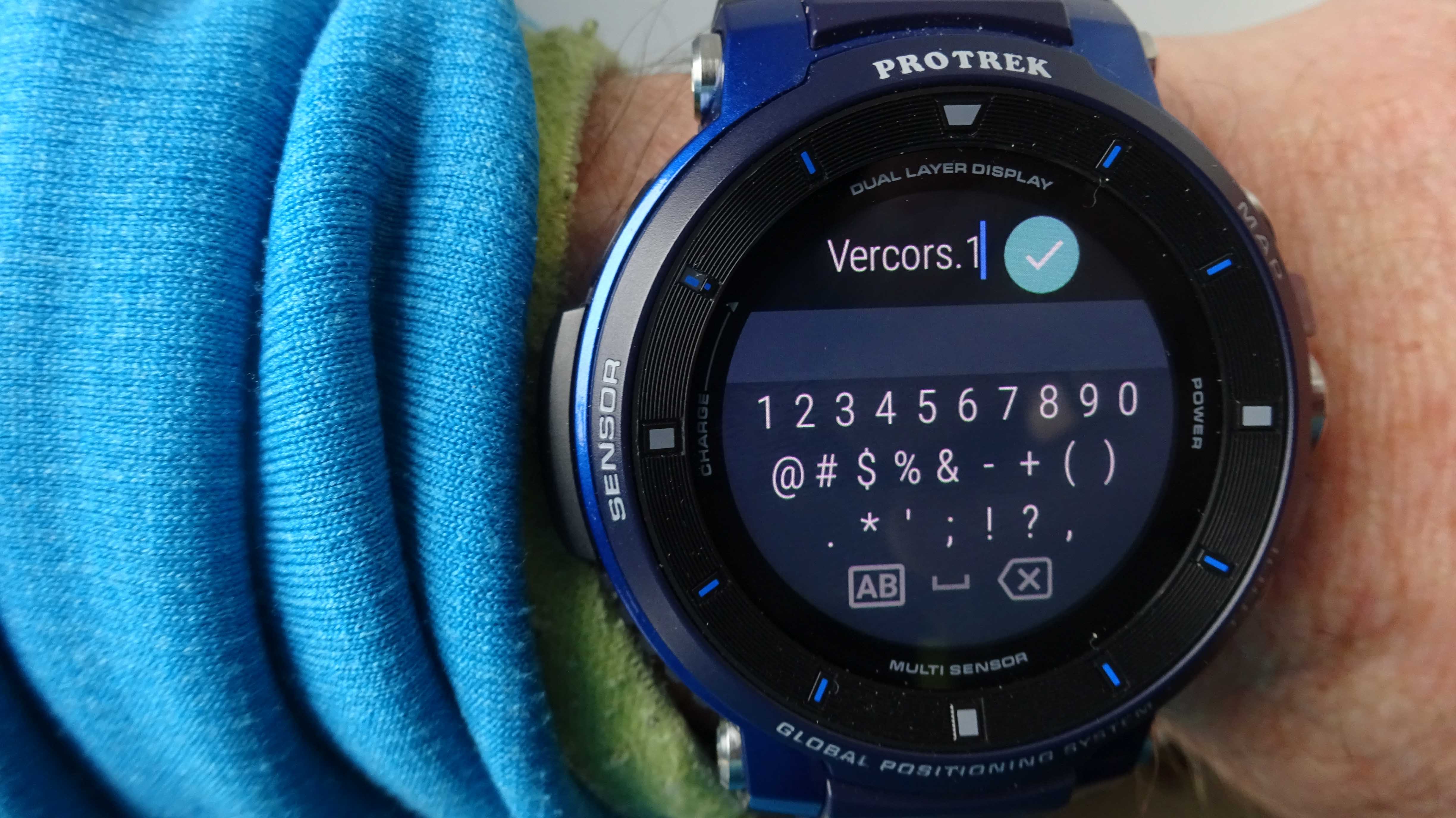
Download the whole area “Vercors” on Viewranger represents about 10000 tiles and the upload took about 30mins on WIFI.
If you want the IGN maps, a year’s subscription to the IGN portal is on offer for 17.38 euros.
It is possible to download quite a large IGN area (We tried and downloaded 4200 tiles (Vercors) from the IGN France map in 20 minutes. When downloading the watch indicates “too many tiles” if the area is too big.


A note about the GPS sensitivity:
Inside by a window, we did not manage to get a fix, whilst using a smartphone (without Wi-Fi) Viewranger correctly pinpointed the right position.
It was necessary to connect the watch via Bluetooth with the smartphone so that it homed in.
Outside, without connection to a smartphone, the watch connects correctly to the GPS in 1 or 2 minutes maximum.
Make sure you download the correct area of the map beforehand.
Autonomy:
First day’s use: set-up, testing different functions, used map for three hours, loading a small map area, using the Google wizard a dozen times, connected mode for 3/5thof the time: all the battery was used up….
It is possible to slightly optimize the battery length by using the “battery” option for the GPS to have a more economic mode at the expense of “precision” (other option).
Test on a skiing trip in “normal mode”:
To perform this test we chose the “normal mode” (watch connected, GPS active).
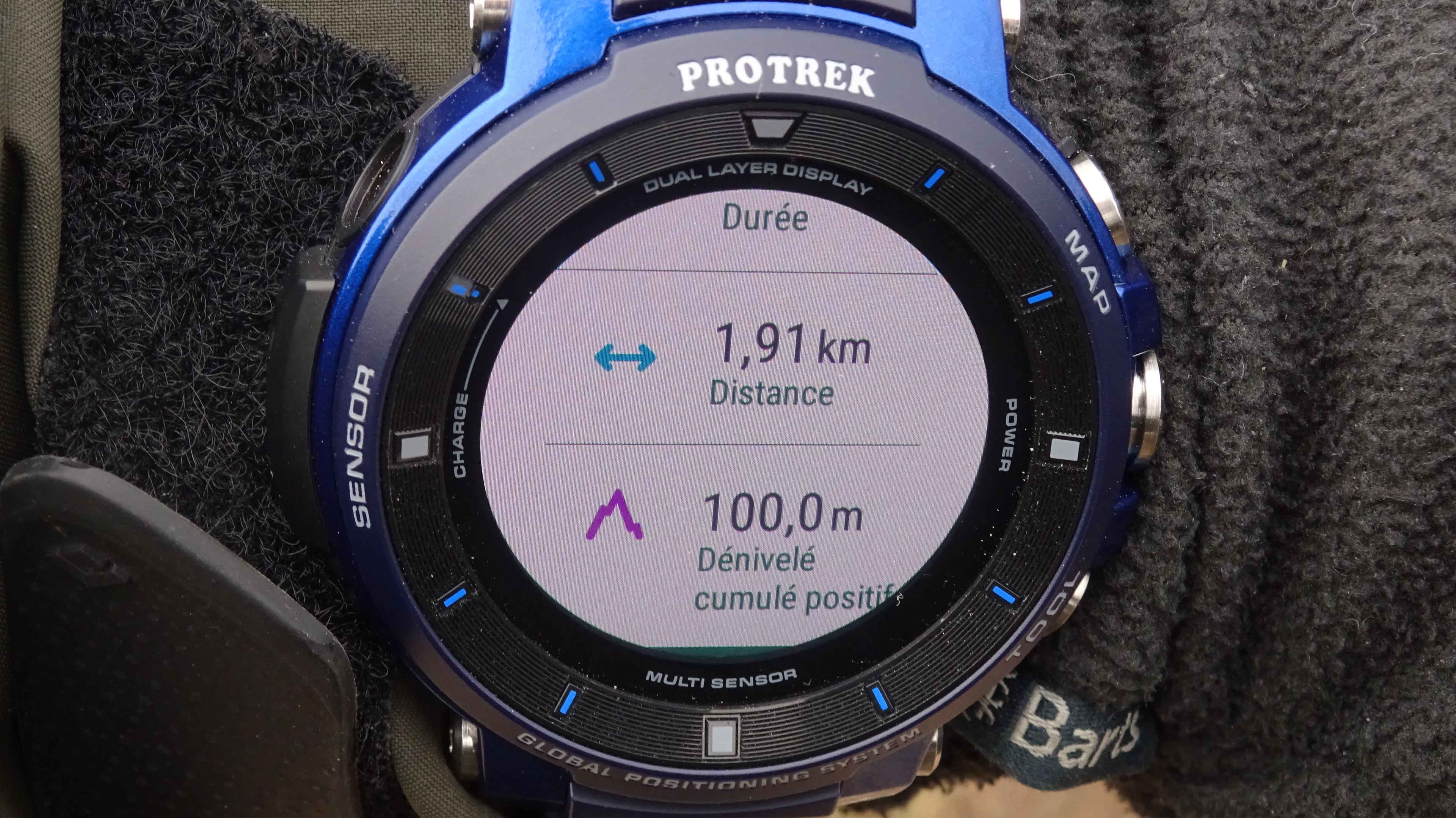
The battery indicated 100% at 10am. Two hours later (a ski touring climb with Viewranger trail and a downhill run with Skitracks), the battery incurred about 25% loss.
The watch was not recharged until the next morning when we simulated a cycling activity for 45mins, with the setting beforehand on the CASIO MOMENT CENTER.

At the end of this test, there was less than 20% battery-life left.
At noon (26 hours), after roughly 3 hours out of 26 of strong activity on GPS and apps, we had used up 90% of the battery knowing that the watch face used was the new two-layer dial which indicates altitude and compass in addition to the watch (the one used by the watch in the “multifunction time machine” mode, which is supposed to be less thirsty on the battery).
The autonomy management was modified, but if you must use the navigation during a long hike (6 to 8h), with point searches, using tracking and tools (compass …), it is better to be careful and have an extra charger.
Alternatively, switch to Extend mode, but with a GPS point every 1min 6min or more … and with a desired result of three days including 8 hours of GPS use.
Casio is getting geared up to launching a clip onto the market, that connects the watch to an external power supply: battery. We were able to get one, once the test is done we will publish the feedback.
Extend mode test
1sttest
Extend mode setting with a 1pm start, a pause at 5pm and a 6pm restart, with a GPS point every minute. At start time, the watch displays 79% battery life and switches to “watch only” mode indicating the time before the tracking starts.
During tracking, we repeatedly viewed the position on the map, it was necessary to wait for the GPS to connect (so every minute with the chosen option, otherwise you have to wait 6 minutes – option 2 – …6 minute wait is long), we also accessed the downloaded routes and did different manipulations.
All functions are available (compass, altimeter ..) but the app “location memory” is not. Why? It’s the only one that allows you to go to a specified point on the map.
Extend mode stopped around 7pm, so 5 hours operating time in Extend mode, the watch displays 50% battery.
Basically, we doubled the autonomy compared to the normal mode, 29% of the battery in 5 hours of activity.
2ndtest
Ski touring trip with a start at 9am, a break at 1pm, and a restart at 1:30 pm, with a GPS point every minute. At start-up the watch had 93% battery life.
We focused on trying not to use too many different watch functions, just viewing the position every hour.
We stopped recording after four hours of skiing, the watch had 79% battery.
Roughly 15% of the battery was used in 4 hours.
We could extrapolate these two tests, so that in Extend mode, without using too many of the various functions, the watch can handle between 20 and 25 hours of GPS activity, with a GPS point every minute.
If you want to take 4 days, using the GPS four to five hours a day, you will probably have to combine several modes:
– Extend mode for 5 hours per day (GPS every minute, and even better every 6 minutes).
– “multifunction time device” mode outdoor option, the rest of the time to limit consumption.
A 4-day testwas performed to validate this hypothesis.
Test start March 19th7:15 am 97% battery life
Extend mode: 11:00 am-12:30 pm, pause and restart at 3:30 pm- 7:00 pm (5h of use, GPS point every minute)
Multifunction time switch mode from 7:00 pm.
March 20th7:15 am 65% battery
Extend mode 7:15 am- 10h, pause and restart at 12:00 pm
Multifunction time switch from 2:00 pm- 5:00 pm
Then Extend mode from 5:00 pm- 7:00 pm.
7hours in Extend mode, GPS point every minute
At 7:00 pm, there is 34% battery left.
Switch to multi-function time device mode.
March 21st at 10:30 pm
Multifunction time device mode. No activity.
31% battery remaining.
March 22ndnormal mode. No follow-up activity. In the evening, there is 11% battery left.
Over 4 days, with four time intervals in Extend modes corresponding to the activity periods, representing approximately 12 hours of GPS use, the rest of the time shows it being in multifunction time device mode to avoid consumption, the watch held out for four days.
Attention, you must leave the multifunction time device mode and start the Extend mode manually.
You can’t do these two modes one after the other, alternately and automatically.
The battery management and the different modes require a lot of practice to calibrate the setting according to its activity.
Back on the skitracks app.
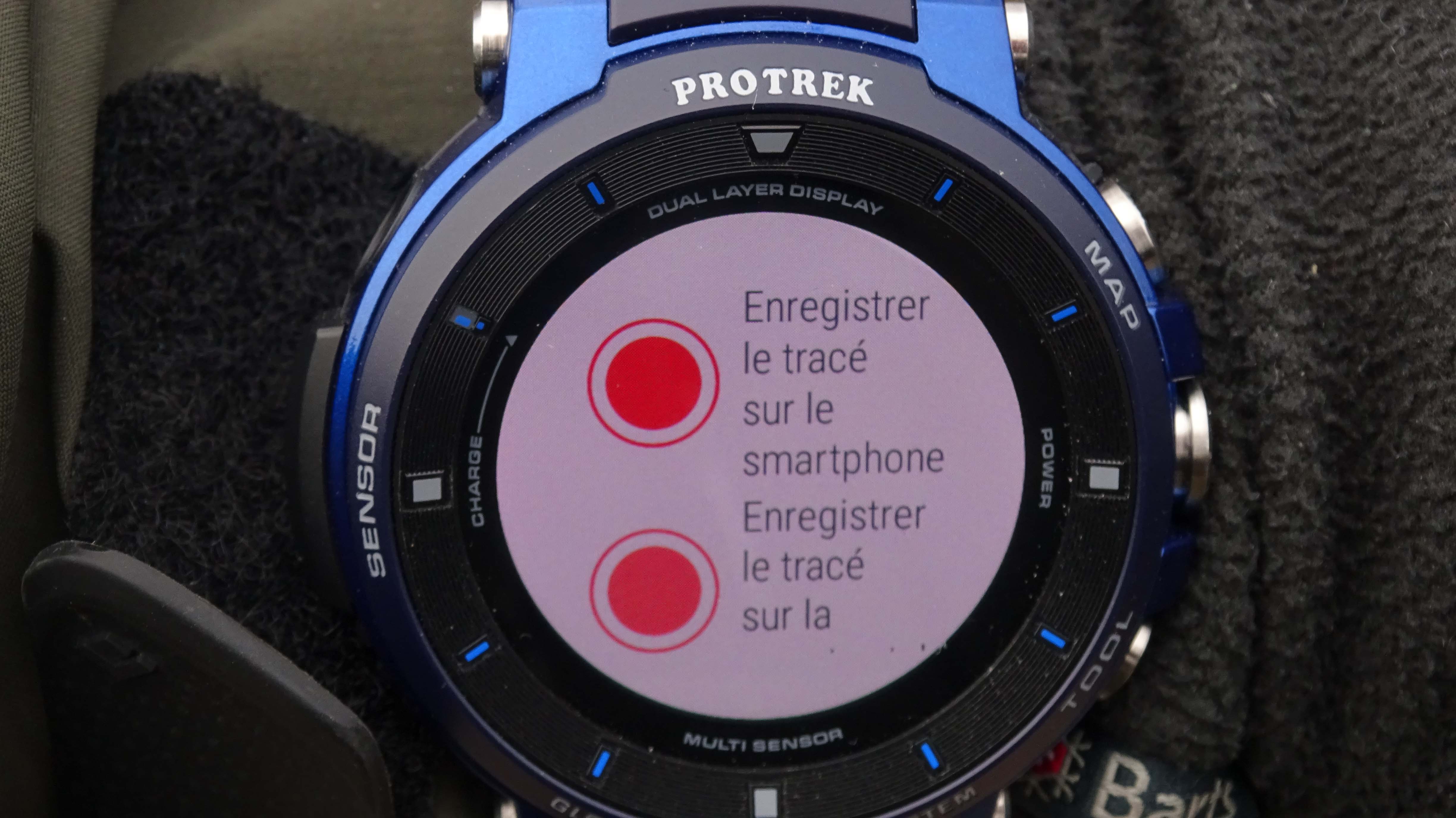
During our ski test we tested the Skitracks app.
In fact, the app on the watch only allows you to control the start of recording, pause and stop on the phone and view the route data.
If you are not connected to Bluetooth on the watch, it won’t record. The recording is always stored on the smartphone.
Very limited interest, CASIO should offer more Standalone apps like Viewranger .
Legibility:
In full sun, most of the proposed screens remain illegible despite this new OLED screen. It is often necessary to tilt the watch according to the light because there are a lot of reflections and this type of screen’s contrast remains insufficient (except for displaying the IGN map, which shows up admirably).
Navigation:
Like all watches of this type, it is necessary to download the itineraries before heading out.
To do this your smartphone must be connected to Bluetooth.
The CASIO’s big advantage is that you can also download maps and use them offline (without smartphone).

We did see some differences in the navigation compared to previous models:
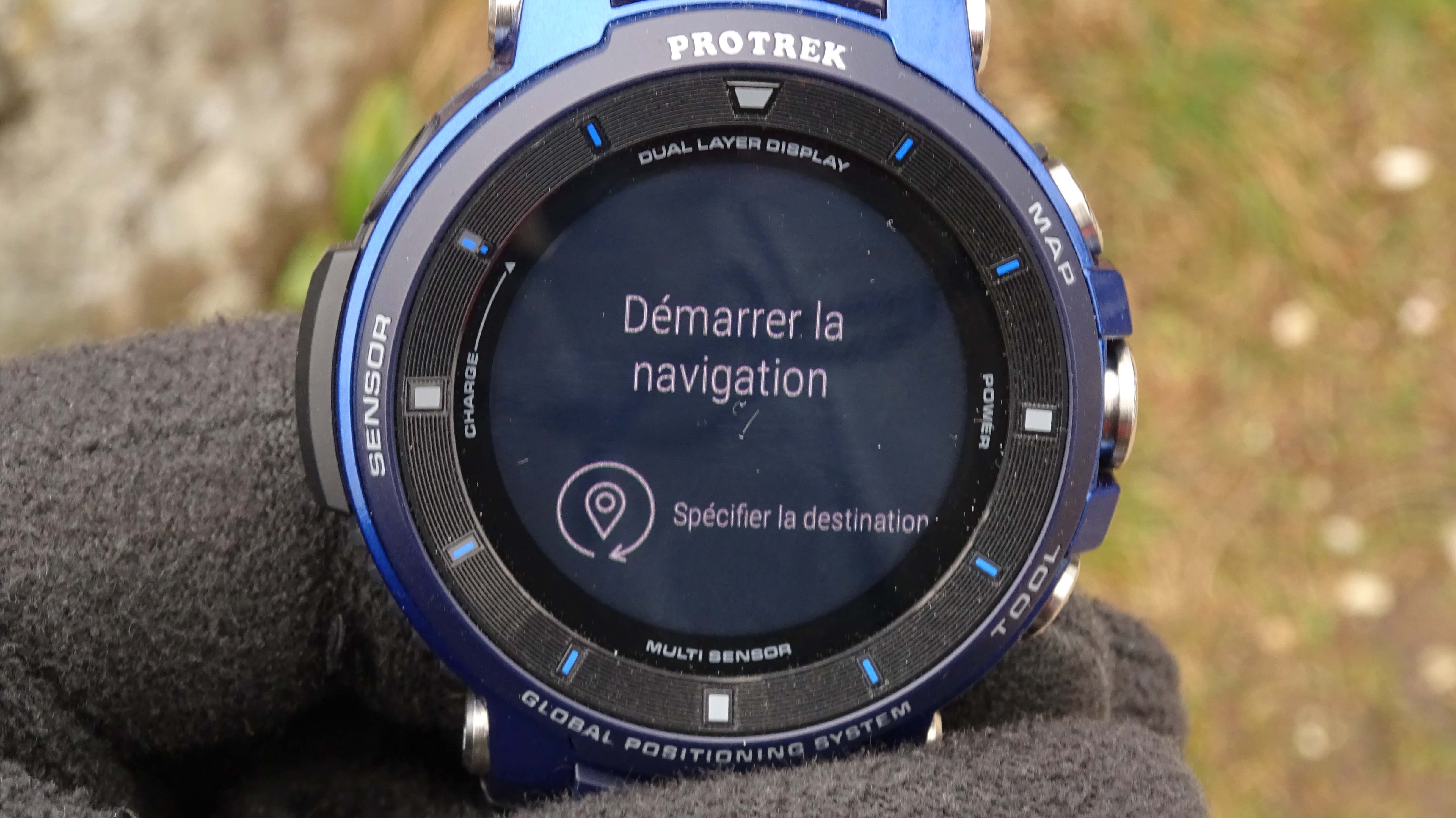
– It is now possible, when hiking to specify a point on the map of the “memory location” app and navigate to it.
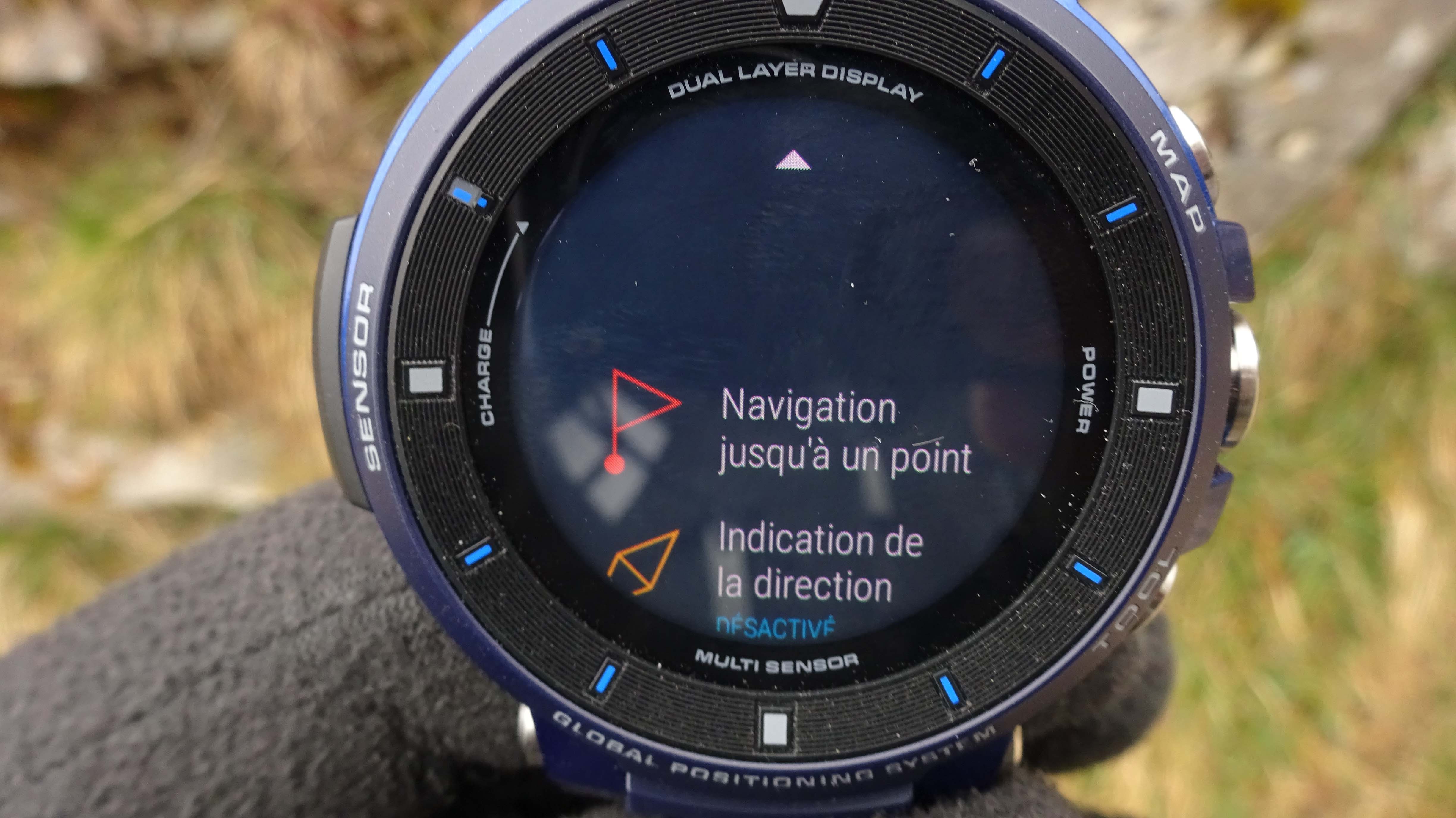
Use the “navigate to a point” menu, position it by clicking on the map and start navigation. (PHOTOS)
The watch indicates the direction to follow, there’s a dotted line to the target point (dotted lines do not follow the paths though, but a direction on the map, so be careful), and a blue triangle indicates the orientation.

But there is no arrow oriented like a compass, nor a precise heading to follow with an internal map (memory location) whose definition is far from being as clear as an IGN map.
It isn’t very practical or accurate whilst using it, and it is necessary to transfer its position onto a larger map in order to decipher the best possible route, for example to avoid rocky bars, or follow streams, to go into a valley, etc.
The GPS seems reliable (on the ground) but is not precise (in meters) on the position.
The Viewranger app, is still more accurate, even if there is no function to go to a point or backtrack.
You are still notified by the watch, when the route crosses a point on the downloaded route.
It is still not easy to follow a track due to the small-sized screen.
Our first conclusions after several weeks using this watch:
The undeniable “+” of CASIO is providing an autonomous watch with cartography:
Either via the “location memory” app (the simplest and least precise),
Or via the Viewranger app, which is totally Standalone, the increased definition of the screen to zoom in on an area. The basic “landscape Viewranger ” map (free) has very good definition (contour lines every 10m).
The loaded route points are clearly visible.
The IGN map use brings even more precision.
Where we are disappointed:
– practicality in use (the limited touch-screen and a very small map) especially for navigation
– missing basic navigation functions (backtracking, go to a point whose GPS coordinates are given, mark a specific point on the Viewranger app)
– the GPS does not give its precision in meters. You have to download an Android app.
– legibility in bright light, however, at night, the backlit screen is perfect.
– Autonomy management (the Extend mode does not correspond to realistic use in the mountains), and requires precise management to prevent the watch from being fully discharged after two days.
The principle of the three modes is too restrictive because it is necessary to constantly think to adapt the parameters and the mode changes.
This watch remains a pretty connected jewel, CASIO has perfectly integrated the Wear OS functions (Google assistant, embedded music, notifications management, texts, e-mails, Facebook notifications, WhatsApp, Google map …) as well as the most interesting functions in hiking ( carto, altimeter, compass…).
We are often in a situation where the watch is just controlling an app on the smartphone, it would be interesting to have more Standalone apps like Viewranger .
The basic navigation functions “go to a point defined by these coordinates” or make a “backtrack” are cruelly lacking, the embedded cartography concept, despite its excellent quality with a small screen it is not without constraints and is not what you’d look for when going on a mountain trip: a simple and effective tool.

We used this equipment over a long period of time
These are our thoughts after intensive use:
Receive your answers by mail. Do you have a particular question concerning the design, use, durability or other about a tested product? We will answer your question personally.